Info: 6 amazing clouds
1. MAMMATUS CLOUDS
Description:
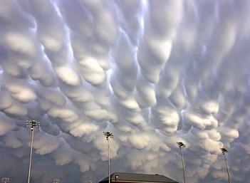
Mammatus (also known as mammatocumulus, meaning "bumpy clouds"[citation needed]) is a meteorological term applied to a cellular pattern of pouches hanging underneath the base of a cloud. The name "mammatus" is derived from the Latin mamma (udder), due to the clouds' characteristic shape.(Source)

2. ALTOCUMULUS CASTELANUS
Description:
Altocumulus Castellanus (ACCAS) is named for its tower-like projections that billow upwards from the base of the cloud. The base of the cloud can form as low as 2,000 metres (6,500 feet), or as high as 6,000 metres (20,000 feet).
Castellanus clouds are evidence of mid-atmospheric instability and a high mid-altitude lapse rate. They may be a harbinger of bad weather and, if surface-based convection can connect to the mid-tropospheric unstable layer, continued development of Castellanus clouds can produce cumulonimbus clouds.
Altocumulus Castellanus clouds are typically accompanied by moderate turbulence as well as potential icing conditions. For these reasons, flight through Altocumulus Castellanus clouds is often best avoided by aircraft.
The appearance of Altocumulus Castellanus early in a sunny day may indicate a high probability the formation of thunderstorms in the afternoon, as they may develop into Cumulonimbus cloud storm clouds.(Source)


3. ARCUS CLOUDS
Description:
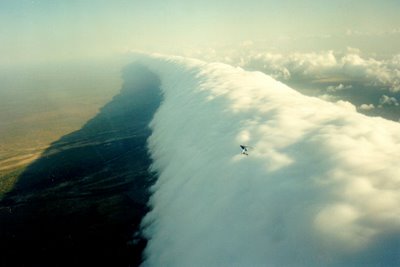
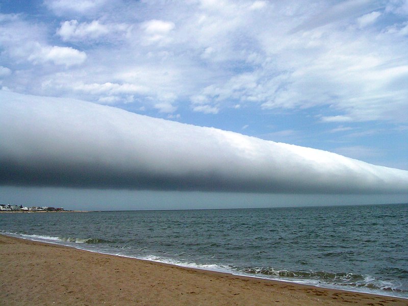
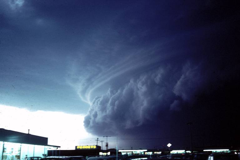
An arcus cloud is a low, horizontal cloud formation associated with the leading edge of thunderstorm outflow, or occasionally with a cold front even in the absence of thunderstorms. Roll clouds and shelf clouds are the two types of arcus clouds, slight variations in their generation and look being the difference.(Source)
a)Roll clouds
Description:
A roll cloud is a low, horizontal, tube-shaped, and relatively rare type of arcus cloud. They differ from shelf clouds by being completely detached from the thunderstorm base or other cloud features. Roll clouds usually appear to be "rolling" about a horizontal axis. They can be a sign of possible microburst activity.(Source)
Video:
b)Shelf cloud
Description:
A shelf cloud is a low, horizontal wedge-shaped arcus cloud. Unlike a roll cloud, a shelf cloud is attached to the base of the parent cloud (usually a thunderstorm). Rising cloud motion often can be seen in the leading (outer) part of the shelf cloud, while the underside often appears turbulent and wind-torn.(Source)

4. NACREOUS CLOUDS
Description:
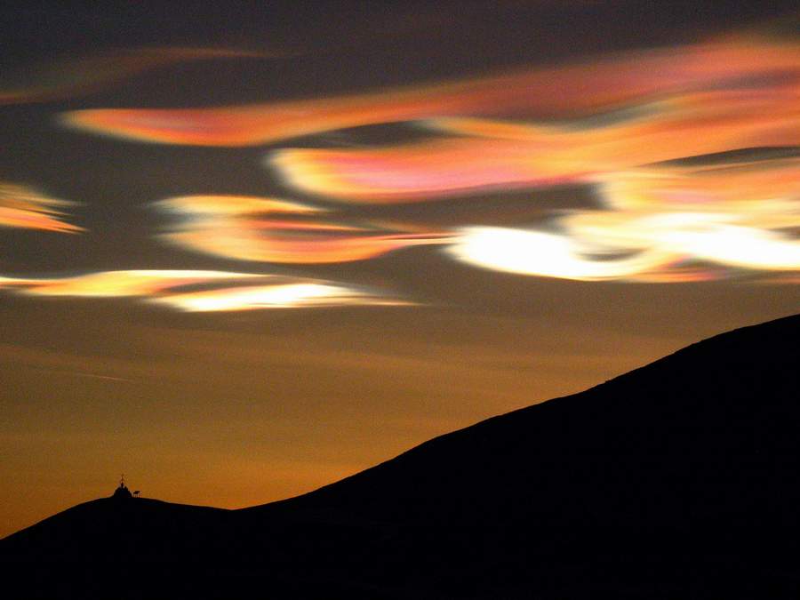
Polar stratospheric clouds (PSCs), also known as nacreous clouds, are clouds in the winter polar stratosphere at altitudes of 15,000–25,000 meters (50,000–80,000 ft). They are implicated in the formation of ozone holes;[1] their effects on ozone depletion arise because they support chemical reactions that produce active chlorine which catalyzes ozone destruction, and also because they remove gaseous nitric acid, perturbing nitrogen and chlorine cycles in a way which increases ozone destruction.(Source)

Video:
5. NOCTILUCENT CLOUDS
Description:
Noctilucent clouds, are tenuous cloud-like phenomena that are the "ragged-edge" of a much brighter and pervasive polar cloud layer called polar mesospheric clouds in the upper atmosphere, visible in a deep twilight. They are made of crystals of water ice. The name means roughly night shining in Latin. They are most commonly observed in the summer months at latitudes between 50° and 70° north and south of the equator.
They are the highest clouds in the Earth's atmosphere, located in the mesosphere at altitudes of around 76 to 85 kilometers (47 to 53 mi). They are normally too faint to be seen, and are visible only when illuminated by sunlight from below the horizon while the lower layers of the atmosphere are in the Earth's shadow. Noctilucent clouds are not fully understood and are a recently discovered meteorological phenomenon; there is no evidence that they were observed before 1885.
Noctilucent clouds can form only under very restrictive conditions; their occurrence can be used as a sensitive guide to changes in the upper atmosphere. Since their discovery the occurrence of noctilucent clouds has been increasing in frequency, brightness and extent. It is theorized that this increase is connected to climate change.(Source)


6. MUSHROOM CLOUDS
Description:
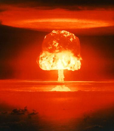
A mushroom cloud is a distinctive pyrocumulus mushroom-shaped cloud of condensed water vapor or debris resulting from a very large explosion. They are most commonly associated with nuclear explosions, but any sufficiently large blast will produce the same sort of effect. They can be caused by powerful conventional weapons like the Mother of All Bombs. Volcano eruptions and impact events can produce natural mushroom clouds.
Mushroom clouds form as a result of the sudden formation of a large mass of hot, low-density gases near the ground creating a Rayleigh–Taylor instability. The mass of gas rises rapidly, resulting in turbulent vortices curling downward around its edges and drawing up a column of additional smoke and debris in the center to form its "stem". The mass of gas eventually reaches an altitude where it is no longer of lower density than the surrounding air and disperses, the debris drawn upward from the ground scattering and drifting back down(Source)

More Info: www.zmescience.com
Subscribe to:
Post Comments (Atom)


0 comments:
Post a Comment